Local guide from Tula & Oak House
Foothills Parkway, Tennessee: What's Open, the Missing Link, and How to Drive It
The Foothills Parkway exists as two separate open sections, West and East, with a long middle gap still unbuilt even after the Missing Link finally opened in 2018. Here is what's actually open, the best overlooks, how to check current NPS closures and the parking tag you need, and honest drive times from a Sevierville base.
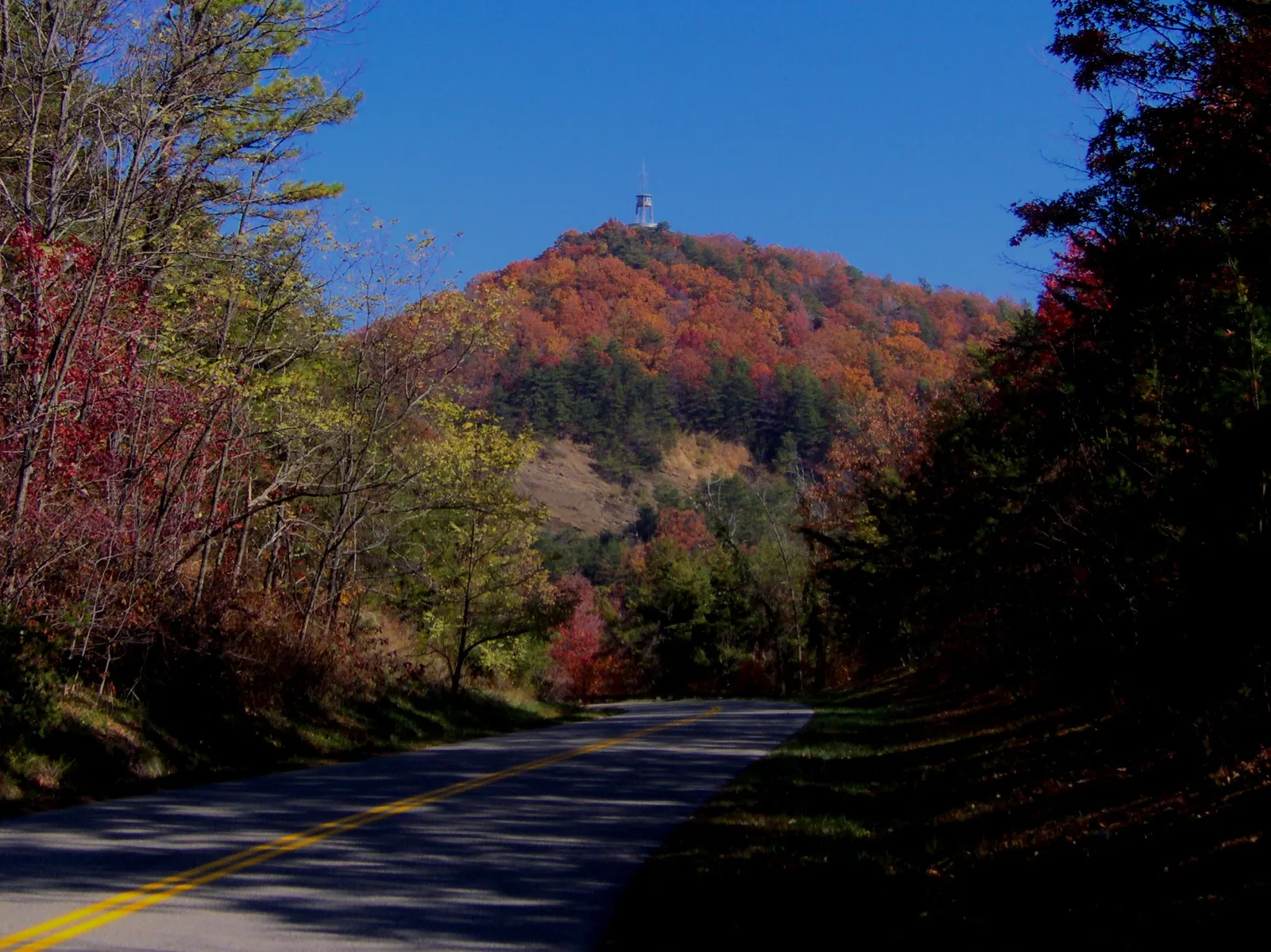
The Foothills Parkway is a Smoky Mountains scenic drive built as two separate finished pieces that do not connect: a 33-mile continuous West section from US-129 at Chilhowee Lake to Wears Valley, and a shorter 6-mile East section from Cosby to Interstate 40. The West section reached its current length in November 2018, when the National Park Service finished the last 16 miles between Walland and Wears Valley, including the famous Missing Link, after decades of partial construction. Below is what is actually open right now, the overlooks worth the stop, current closures and the parking tag you need, and honest drive times from a Sevierville base.
Quick answer
- Foothills Parkway was authorized by Congress in 1944 as a planned 72-mile scenic road from US-129 at Chilhowee Lake to Interstate 40 near Cosby. More than 80 years later, the National Park Service still calls it the oldest unfinished highway project in Tennessee.
- Two sections are open to drive today: Foothills Parkway West, 33 continuous miles from Chilhowee Lake to Wears Valley, and Foothills Parkway East, 6 miles from Cosby to Interstate 40, open since 1968. The two do not connect to each other.
- The last piece of the West section, the 16 miles between Walland and Wears Valley, sat partly built for decades before opening to traffic on November 10, 2018, including the 1.65-mile Missing Link carried across several bridges.
- A roughly 33-mile stretch between Wears Valley and Cosby was never built and has no funded construction schedule, which is why West and East remain separate drives.
- As of October 1, 2026, the National Park Service's road and facility closures page listed no closures on Foothills Parkway West or East. Check it before you go, since a high ridge road can close with little notice.
- A park parking tag is required for any vehicle parked more than 15 minutes anywhere in the park, including the walk to Look Rock Observation Tower: $5 for a day, $15 for a week, or $40 for the year.
Which sections are actually open, and what the Missing Link really means
Congress authorized the Foothills Parkway in 1944, planning a scenic road about 72 miles long from US-129 at Chilhowee Lake to Interstate 40 near Cosby, tracing the foothills along the edge of what is now Great Smoky Mountains National Park. The National Park Service calls it the oldest unfinished highway project in Tennessee, a description that is still accurate more than 80 years after authorization.
By the late 1960s, two pieces of that plan were finished: a 17-mile stretch from Chilhowee Lake to Walland, and a 6-mile stretch from Cosby to Interstate 40 with views toward Mount Cammerer. The 16 miles between Walland and Wears Valley sat only partly built for decades, including a 1.65-mile stretch across Bates Mountain known as the Missing Link, which the National Park Service has described as a multiple-bridge project. The park service finished that 16-mile stretch and opened it to traffic on November 10, 2018, according to Wikipedia's history of the parkway, extending the Chilhowee-to-Walland piece into one continuous 33-mile drive, Foothills Parkway West, ending at Wears Valley.
Foothills Parkway East, the 6-mile Cosby-to-Interstate 40 piece open since 1968, was not part of that 2018 project and still does not connect to the West section. A roughly 33-mile stretch between Wears Valley and Cosby was never built and has no funded construction schedule, so the two open sections remain separate drives rather than one continuous parkway.
Overlooks worth stopping for
Foothills Parkway West is built for pulling over. The 17-mile Chilhowee-to-Walland stretch alone has 16 overlooks, including the popular Look Rock Observation Tower, according to the National Park Service; the same stretch also has the Look Rock Picnic Area and the seasonal Look Rock Campground. The newer 16-mile Walland-to-Wears Valley stretch adds more views into the park.
- Look Rock Observation Tower sits at the end of a paved walk of about half a mile each way from the Look Rock parking area, with a near 360-degree view taking in the Tennessee Valley on one side and the main crest of the Smokies on the other.
- Overlooks on the park side of Chilhowee Mountain tend to work best in morning light, before haze builds up over the ridges.
- Overlooks on the Tennessee Valley side face west and are a good pick in the hour before sunset.
- The Missing Link crosses a series of bridges over the gorge on Bates Mountain, with some of the best views on the drive from the road itself.
Current closures and the parking tag you need
As of October 1, 2026, the National Park Service's road and facility closures page listed no active closures on Foothills Parkway West or East. Other listed closures that day were elsewhere in the park, including Carlos Campbell Overlook, Mingus Mill, Laurel Falls Trail into 2027, and partial Bullhead Trail closures. That can change fast on a high, exposed ridge road. A magnitude 4.1 earthquake centered near Greenback, Tennessee, in May 2025 was felt strongly across East Tennessee, the kind of event that can prompt a bridge inspection closure. Winter ice and storm damage can also close sections with little warning near Look Rock.
Before you drive out, check the park's current conditions page directly, since a guide like this one can go stale between visits, or call the park at (865) 436-1200. The same conditions page covers the rest of the park's roads if you are pairing the drive with Cades Cove or another loop.
The Parkway has no entrance station of its own, but it sits inside Great Smoky Mountains National Park, so the park's parking tag rule applies. A tag is required for any vehicle parked more than 15 minutes anywhere in the park, which includes the walk out to Look Rock Observation Tower: $5 for a day, $15 for a week, or $40 for the year, available at park visitor centers and online. A group arriving in two or three vehicles needs a tag per vehicle. See our guide to Smoky Mountains parking tags and trailhead parking for where to buy one before you go.
How to reach it from Sevierville
From Tula & Oak, the fastest way onto the Parkway is the Wears Valley entrance of the West section: take Waldens Creek Road to Wears Valley Road (US-321), then turn onto the Foothills Parkway West access road. That route is roughly 11 miles and, with no traffic, about 25 minutes; give it 25 to 35 minutes in practice. It does not touch the Pigeon Forge Parkway at all.
Reaching the far ends takes longer: roughly 1 hour 10 minutes to 1 hour 30 minutes from the house to the Chilhowee Lake end near US-129, and roughly 1 hour to 1 hour 20 minutes to the separate East section near Cosby, depending on route and traffic through Pigeon Forge or Gatlinburg. Many groups treat the West section as an out-and-back from Wears Valley rather than driving the full 33 miles one way. A loop works if you are also headed toward Townsend: drive the Parkway from Wears Valley to Walland, then take US-321 through Townsend back toward Wears Valley. If you are already pointed toward Cades Cove by way of Townsend, exiting at Walland and continuing into Cades Cove links the two drives into one day.
Best times to drive it
The Parkway has no gate of its own, so timing is mostly about light, weather, and season rather than hours. Fall color is a popular reason to go, since a ridge-top route shows color at several elevations at once; see our Smoky Mountains fall colors guide for how color moves down the mountain through the season. Spring brings wildflowers and new leaf-out at the lower overlooks first. Clear winter days can deliver long sightlines with none of summer's haze, but ice at the higher elevations near Look Rock is a real risk, so check conditions before a cold-weather trip.
Early morning and the hour before sunset tend to give the best light at the overlooks and the lightest traffic. Weekend afternoons during peak fall weeks can fill the Look Rock parking area.
Where to stay
Tula & Oak sits in Sevierville, about 22 minutes from Great Smoky Mountains National Park and roughly half an hour from the Wears Valley entrance to the Foothills Parkway, so a half day on the Parkway fits around a stay here rather than taking over the trip. The house sleeps 14 across 5 bedrooms and 5 bathrooms, with a private indoor heated pool, hot tub, theater room, and arcade to come back to once everyone has had enough curves and overlooks, which matters when not everyone wants to ride along for a multi-hour drive. See our guide to Smoky Mountain cabins with a private indoor pool for more options.


